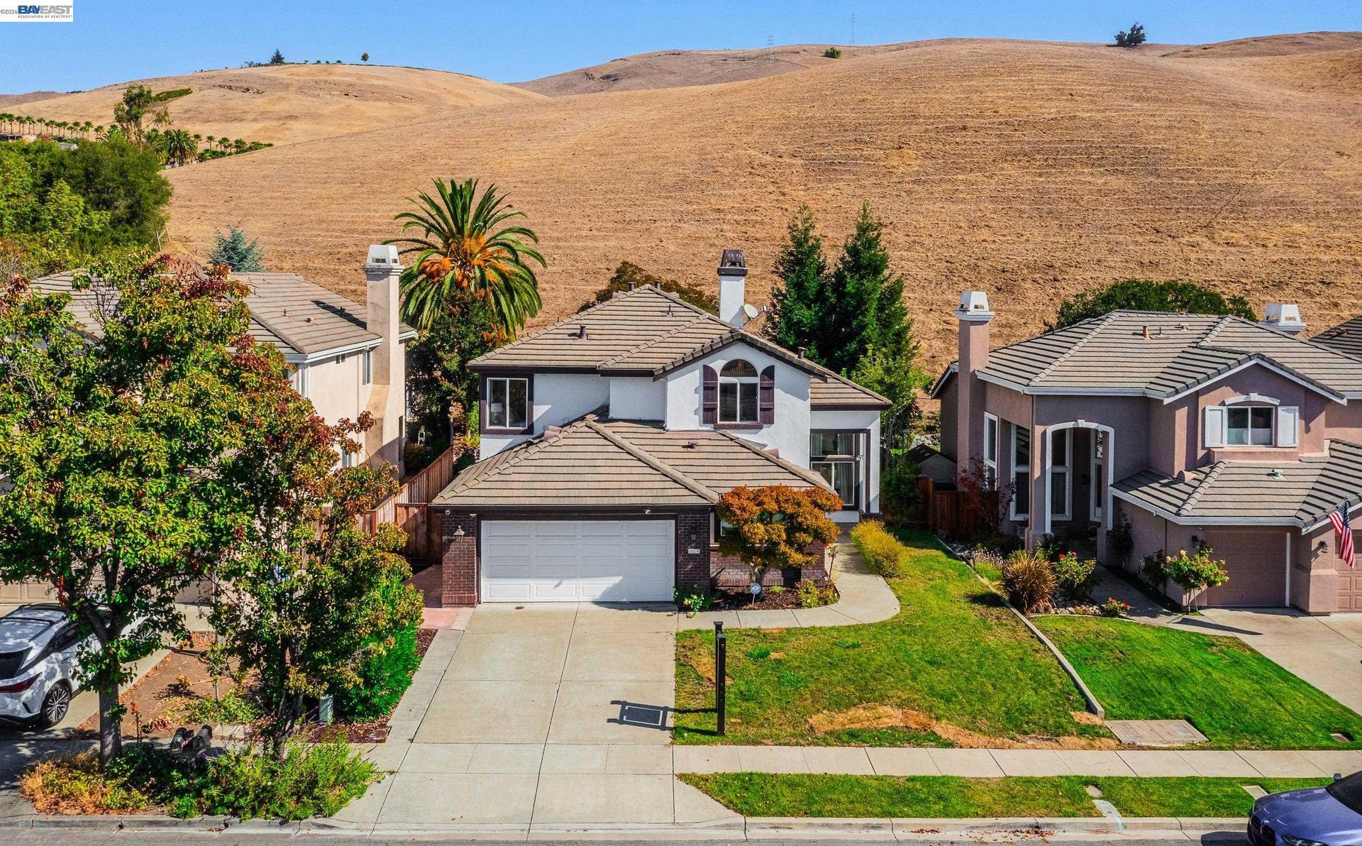

Los Altos Hills: Large Lots & Hillside Living
Updated November 06, 2026

Los Altos Hills: Large Lots & Hillside Living
Los Altos Hills is a primarily residential town in Santa Clara County known for large parcels, hillside terrain, custom homes, an extensive pathway system, open space, and access to nearby Peninsula employment and commercial centers. Property conditions can vary considerably based on slope, lot configuration, road access, utilities, drainage, vegetation, and development history.
📝 Introduction
Los Altos Hills is located between Los Altos, Palo Alto, Stanford University, Interstate 280, and the eastern slopes of the Santa Cruz Mountains. Incorporated in 1956, the Town developed around a low density residential pattern rather than a downtown or commercial core. Its setting includes rolling terrain, wooded parcels, open space, pathways, custom residences, and roads that follow the contours of the foothills.
📍 What Defines Los Altos Hills
- Residential zoning generally reflects a one acre minimum lot standard, although existing parcels and property specific conditions can vary.
- Slopes, creek corridors, mature trees, drainage patterns, and irregular parcel shapes influence development across many parts of Los Altos Hills.
- An extensive network of roadside and off road pathways connects residential areas with schools, recreation facilities, open space, and neighboring trail systems.
- Los Altos Hills does not contain a conventional downtown or commercial business district, making nearby Los Altos, Palo Alto, Mountain View, and other Peninsula cities important for retail and services.
- Town preserves, pathway easements, privately maintained open land, and nearby regional preserves contribute to the physical setting of Los Altos Hills.
🎉 Fun Fact
Town materials describe approximately 80 miles of trails and off-road paths distributed throughout Los Altos Hills. The system developed as an alternative to a conventional sidewalk network and provides connections between residential streets, local facilities, and nearby open space.
🏡 Residential Setting and Housing
- Large Lot Homes: Detached residences are commonly positioned on larger parcels, creating substantial differences in setbacks, usable land, landscaping, and site configuration.
- Custom Construction: Housing ranges from older ranch style properties to contemporary custom residences, remodeled homes, and rebuilt estates with varied architectural approaches.
- Hillside Properties: Homes on sloped parcels may involve retaining structures, grading, drainage systems, geotechnical review, stepped foundations, and driveway design.
- Accessory Structures: Depending on the parcel and applicable regulations, properties may include accessory dwelling units, barns, garages, pools, workshops, or other secondary improvements.
- Private and Interior Roads: Some residences are reached through narrow roads, shared driveways, private access routes, or longer interior drives, making maintenance and access conditions relevant to property review.
💼 Business and Employment Areas
- Within Los Altos Hills: Conventional retail, office, and commercial districts are generally absent because the Town's land use pattern is primarily residential.
- Downtown Los Altos: Restaurants, stores, offices, personal services, and civic facilities form one of the closest concentrated commercial districts.
- Palo Alto and Stanford: Stanford University, medical facilities, research organizations, offices, and commercial districts are located north of Los Altos Hills.
- Mountain View Employment Areas: Office, technology, research, retail, and service businesses in Mountain View are accessible from the Town through local roads and regional routes.
- Interstate 280 Corridor: Interstate 280 provides regional connections toward employment centers throughout the Peninsula and into San Jose.
📊 Real Estate Overview
Los Altos Hills real estate is shaped as much by the land as by the residence itself. Two homes with similar interior square footage can differ substantially in slope, usable outdoor area, road access, drainage, tree coverage, easements, utilities, development potential, and existing site improvements. Town planning review can also involve grading, open space easements, pathways, landscaping, drainage, and site development depending on the property and proposed work.
Property Differences by Setting
- Relatively level parcels can differ substantially from steep hillside properties in usable land, driveway configuration, grading, drainage, foundation design, and the placement of existing improvements.
- Properties reached by private roads, shared driveways, or longer interior access routes may involve maintenance agreements, easements, emergency access considerations, and different road conditions from homes on public streets.
- Older ranch style residences, extensively remodeled homes, and newer custom construction can also differ considerably in permitted improvements, building systems, accessory structures, and development history.
- Pathway easements, creek areas, mature trees, open space easements, and other site features can affect how portions of a larger parcel function even when the total acreage appears similar to nearby properties.
Development and Land Use Context
- Infrastructure can vary from one parcel to another. The Town has sanitary sewer infrastructure, while some properties continue to use onsite wastewater systems. Current Town guidance states that a new residence or certain major additions to a property with an existing septic system may require abandonment of the septic system and connection to public sewer. Buyers and sellers should review the utility configuration, permit history, site improvements, access, and other property records for the individual address.
- Town development review can also address grading, landscaping, pathway obligations, open space easements, drainage, setbacks, and other parcel-specific conditions. Proposed additions, replacement homes, ADUs, or substantial site improvements should therefore be evaluated using current Town requirements for the individual property.
🌳 Parks, Trails and Local Attractions
- Byrne Preserve: This Town owned preserve along Altamont Road includes open land connected with local pathways and neighboring Westwind Community Barn.
- Westwind Community Barn: Located on Altamont Road, this Town facility provides horse boarding, riding facilities, programs, and access to nearby pathways.
- Rancho San Antonio County Park and Open Space Preserve: Located near the eastern side of Los Altos Hills, this regional recreation area contains an extensive trail network across the preserve and adjoining County park.
- Foothills Nature Preserve: Located along Page Mill Road, this Palo Alto managed preserve contains hiking trails through woodland, meadow, creek, and hillside environments.
- Purissima Park: This Town facility on Purissima Road includes recreational space, a riding ring, and a dog park.
🏘️ Residential Settings Across Los Altos Hills
- Central Los Altos Hills: Residential streets around Fremont Road, Town Hall, and nearby local facilities include larger parcels, custom homes, pathways, and established landscaping.
- Altamont and Western Hills: Properties toward Altamont Road and the higher terrain have closer relationships to slopes, wooded land, Byrne Preserve, Westwind Community Barn, and winding residential roads.
- Page Mill Road Area: Homes near the western and northern portions of Page Mill Road can involve hillside terrain, longer access routes, vegetation, and connections toward Palo Alto and nearby preserves.
- Purissima and Moody Road Area: Residential properties in this part of town include varied terrain, large parcels, pathway connections, and roads extending toward open space and the eastern foothills.
- Eastern Los Altos Hills: Properties closer to El Monte Road, Foothill College, Interstate 280, and the Los Altos boundary generally have more direct connections to surrounding Peninsula roads and commercial areas outside the Town.
🚆 Transportation and Regional Access
- Interstate 280 provides the principal regional freeway connection near Los Altos Hills, linking the area with Palo Alto, Mountain View, San Mateo County, and San Jose.
- Page Mill Road crosses the western portion of the area and provides connections toward Palo Alto and the Santa Cruz Mountains.
- El Monte Road connects Los Altos Hills with Los Altos, Foothill College, and access toward Interstate 280.
- Foothill Expressway runs along the eastern side of the area and provides access toward Los Altos, Palo Alto, and neighboring Peninsula communities.
- Fremont Road, Purissima Road, Altamont Road, Moody Road, and smaller hillside streets follow the Town's terrain, so travel routes and access conditions can differ substantially by property.
📚 Schools and Education
- Los Altos High School: This Mountain View Los Altos Union High School District campus serves portions of Los Altos Hills and offers Advanced Placement courses, Career Technical Education, visual and performing arts, world languages, and other academic programs.
- Henry M. Gunn High School: This Palo Alto Unified School District campus offers academic programs in science, mathematics, humanities, world languages, Career Technical Education, arts, and Advanced Placement subjects.
- Egan Junior High School: Egan is one of the junior high schools operated by Los Altos School District, which serves portions of Los Altos Hills along with areas of Los Altos and neighboring communities.
- Gardner Bullis Elementary School: Located on Fremont Road within Los Altos Hills, Gardner Bullis is an elementary campus operated by Los Altos School District.
- Lucille M. Nixon Elementary School: This Palo Alto Unified School District elementary campus is located near Stanford and serves students within portions of the district.
- Higher Education: Foothill College's main campus is located on El Monte Road in Los Altos Hills. The community college offers associate degrees, transfer programs, Bachelor of Science degrees in Dental Hygiene and Respiratory Care, career education, certificates, and online coursework across a broad range of academic fields.
✅ What Can You Do?
For Buyers
- Review the parcel's slope, usable land, drainage, creek conditions, mature trees, and recorded easements because these features can materially affect how a Los Altos Hills property can be used.
- Check Town planning and permit records for additions, rebuilds, retaining walls, pools, accessory structures, grading, and other substantial improvements made over time.
- Confirm whether the property uses public sewer or an onsite wastewater system and review available records for the infrastructure serving the specific parcel.
- Examine pathway easements, open space easements, shared access, private roads, and driveway conditions because these items can affect portions of larger hillside properties.
- For homes on sloped or wooded sites, review applicable fire hazard information, geotechnical conditions, drainage, vegetation, and emergency access as part of the property evaluation.
For Sellers
- Gather plans and permits for additions, rebuilds, accessory structures, retaining walls, pools, grading, drainage work, and substantial site improvements before marketing the property.
- Document the parcel's sewer or septic configuration, road access, easements, pathway obligations, and other infrastructure that may not be apparent during an initial property tour.
- Describe lot acreage separately from usable outdoor areas when slope, creeks, easements, or terrain affect how portions of the property function.
- Verify statements about views, pathway access, open space, or neighboring preserves so marketing reflects the property's actual location and property rights.
- Use comparable sales with similar lot conditions, terrain, residence size, age, improvements, and road setting rather than comparing the property only by total acreage or interior square footage.
❓ FAQ
Q: Does Los Altos Hills have a downtown or commercial center?
A: No conventional downtown or commercial district exists within the Town. Los Altos Hills is primarily residential, while nearby Los Altos, Palo Alto, Mountain View, and other Peninsula communities provide most retail, office, dining, and commercial services.
Q: Are all Los Altos Hills lots at least one acre?
A: No. Residential zoning generally reflects a one acre minimum lot standard, but existing parcels and property specific circumstances can vary. Individual parcel records should be reviewed when researching a property.
Q: Do all Los Altos Hills properties use public sewer service?
A: No. The Town has sanitary sewer infrastructure, while some properties use onsite wastewater systems. The applicable utility arrangement depends on the individual parcel and available infrastructure.
🔚 Conclusion
Los Altos Hills is characterized by large residential parcels, hillside terrain, custom homes, pathways, open space, and development patterns that differ from nearby cities with conventional commercial centers. Parcel configuration, slope, utilities, road access, easements, drainage, and construction history can vary substantially between properties, making property specific research an important part of evaluating real estate in the Town.
This blog is for general informational purposes only and does not constitute legal, tax, accounting, investment, or professional advice. Always consult with qualified professionals before making any decisions based on this content. School information including addresses, phone numbers, and emails was accurate as of the blog’s published date but may change without notice. Please verify directly with the school or institution. This content is provided “as is,” without warranties of any kind. If you are currently under an exclusive agreement with another real estate broker, this blog is not intended as a solicitation.
Contact Us