East Palo Alto: From Whiskey Gulch to University Circle
Updated October 14, 2026
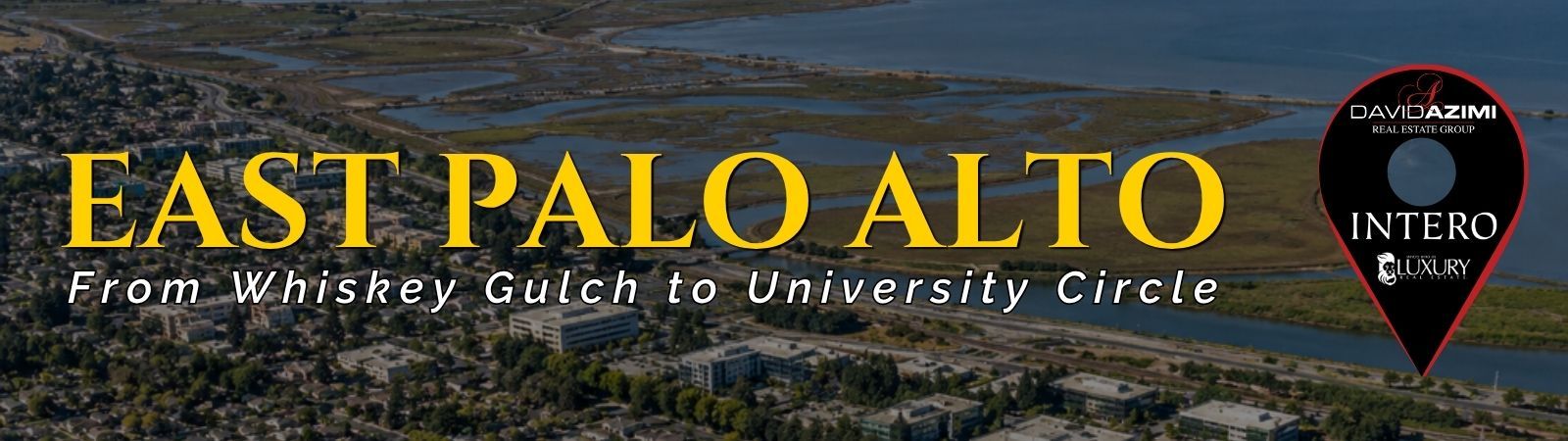
East Palo Alto: From Whiskey Gulch to University Circle
East Palo Alto is a compact Peninsula city with established residential neighborhoods, commercial corridors, major redevelopment areas, local parks, Bay access, and connections to nearby employment and transportation centers. Housing includes detached single family homes, apartments, multifamily properties, townhomes, condominiums, accessory dwelling units, and newer mixed use development.
📝 Introduction
East Palo Alto is a compact Peninsula city with established residential neighborhoods, local commercial areas, parks, Bay access, and an ongoing history of redevelopment and land use change. University Avenue, Bay Road, University Circle, and the Ravenswood Business District each represent different parts of the city’s physical and commercial setting. Ongoing planning around Four Corners, Bay Road, and Ravenswood continues to shape how residential, business, public, and mixed use areas connect across the city. These local differences provide useful context when researching East Palo Alto real estate.
📍 What Defines East Palo Alto
- University Avenue is one of the city’s principal transportation and commercial corridors and provides access across U.S. 101 toward Palo Alto.
- University Circle is the office and hotel district developed on the former Whiskey Gulch site near Highway 101 and University Avenue.
- Bay Road connects residential areas, the Four Corners area, civic uses, the Ravenswood Business District, and Cooley Landing.
- The Ravenswood Business District and Four Corners area are covered by a specific plan adopted in December 2024 that guides future housing, commercial development, public spaces, transportation, and infrastructure.
- The Westside, University Village, the Gardens, Weeks, Kavanaugh, and Palo Alto Park are among the residential areas identified in city planning documents.
- Cooley Landing provides public access to the Bay and connections to the regional Bay Trail.
🎉 Fun Fact
The area now known as University Circle was formerly called Whiskey Gulch. Beginning in the late 1990s, the former mixed retail and residential district was redeveloped with office buildings and a hotel. The Four Seasons Hotel at University Circle opened in 2006, creating a very different land use pattern from the earlier Whiskey Gulch business district.
🏡 Residential Setting and Housing
- Single Family Homes: Detached homes are common throughout established residential areas and vary in lot size, age, architecture, additions, and remodeling history.
- Apartments and Multifamily Housing: Multifamily properties are located throughout several sections of the city and range from smaller buildings to larger residential developments.
- Townhomes and Condominiums: Attached housing is found in selected developments and provides another component of the local housing inventory.
- Accessory Dwelling Units: ADUs may provide additional residential space on qualifying properties and are part of the city’s housing planning framework.
- Newer Mixed Use Housing: Current planning around Four Corners, Bay Road, and other designated areas includes additional residential development alongside retail, commercial, and public uses.
💼 Business and Employment Areas
- University Circle: Located near University Avenue and U.S. 101, this district includes office buildings, hotel uses, and commercial activity on the former Whiskey Gulch site.
- Gateway 101 Area: Commercial properties near East Bayshore Road and Highway 101 include major retail and service uses with regional road access.
- Four Corners and Bay Road: The University Avenue and Bay Road intersection is an important civic and commercial area with housing, retail, public facilities, and planned mixed use development.
- Ravenswood Business District: This northeastern portion of the city contains a mix of industrial, office, institutional, residential, and commercial uses and is undergoing long term planning for additional development.
- Neighborhood Retail: Smaller commercial locations along local corridors provide additional restaurants, shops, and services throughout East Palo Alto.
📊 Real Estate Overview
East Palo Alto real estate includes older residential streets, newer housing projects, multifamily properties, commercial corridors, and areas experiencing substantial land use change. Property comparisons can differ considerably depending on whether a home is located near University Avenue, within an established interior residential area, close to U.S. 101, or near the Bay Road and Ravenswood planning areas.
Residential Property Context
- Detached homes in established neighborhoods can vary in lot configuration, age, additions, remodeling history, parking, and surrounding development. Apartments, townhomes, condominiums, and newer multifamily housing add other property types that require different comparable sales.
- Properties near San Francisquito Creek, the Bay, major streets, or changing development areas may also involve site specific considerations that should be reviewed as part of property research.
Development and Commercial Context
- University Circle represents one of the city’s most visible redevelopment areas, while Four Corners and the Ravenswood Business District are part of a newer planning framework for additional housing, retail, employment uses, public space, and transportation improvements.
- Commercial property analysis should consider the specific district because an office property at University Circle, a retail site near Highway 101, and a property along Bay Road can have very different zoning, access, building, parking, and development characteristics.
🌳 Parks, Bay Access and Local Attractions
- Cooley Landing Park: Located at the eastern end of Bay Road, Cooley Landing provides Bay views, trails, an education center, picnic areas, native landscaping, and a connection to the Bay Trail.
- Jack Farrell Park: Includes a baseball field, basketball facilities, playground areas, outdoor exercise equipment, and open grass areas.
- Bell Street Park: Located near University Avenue, this city park includes open lawn space and a skate park.
- Martin Luther King Jr. Park: Provides athletic fields, picnic areas, and recreational space.
- Joel Davis Park: Includes picnic areas and playground facilities within an established residential area.
- Bay Trail: East Palo Alto’s waterfront provides connections to the broader regional Bay Trail system and surrounding Baylands.
🏘️ Residential Areas Across East Palo Alto
- Westside: Located west of Highway 101 along San Francisquito Creek, this area contains a mix of detached and multifamily housing with connections toward University Avenue, Palo Alto, and Menlo Park.
- University Village: An established residential area east of University Avenue with primarily detached housing and a distinct street grid.
- The Gardens: Located toward the eastern side of the city, this area is primarily residential and includes homes developed largely during the mid twentieth century.
- Weeks Neighborhood: Residential streets in this portion of East Palo Alto include detached homes and multifamily properties near local roads and commercial corridors.
- Kavanaugh and Palo Alto Park Areas: These established residential sections contain housing developed during different periods with varying lot and street configurations.
🚌 Transportation and Regional Access
- East Palo Alto is served primarily by SamTrans bus and on demand transportation rather than having its own Caltrain station.
- SamTrans routes provide connections within East Palo Alto and toward Palo Alto, Stanford, Redwood City, Menlo Park, and other Peninsula destinations.
- Ride Plus provides on demand transportation within East Palo Alto and Belle Haven and connects with the Palo Alto Transit Center.
- The nearby Palo Alto Transit Center provides access to Caltrain as well as additional regional bus and shuttle connections.
- The Dumbarton Express provides transportation across the Dumbarton Bridge toward East Bay destinations.
- Major road connections include U.S. 101, University Avenue, East Bayshore Road, Bay Road, Willow Road, and access toward State Route 84 and the Dumbarton Bridge.
📚 Schools and Education
- East Palo Alto Academy: A public charter high school within Sequoia Union High School District offering a college preparatory program, project based learning, athletics, and additional academic support.
- César Chávez Ravenswood Middle School: Serves grades 6 through 8 within Ravenswood City School District and offers academics together with electives that include art, band, Spanish, and other programs.
- Costaño School of the Arts: A Ravenswood City School District elementary campus incorporating arts programming alongside elementary academic instruction.
- Los Robles-Ronald McNair Academy: A Spanish-English dual language immersion elementary school operating as a choice program within Ravenswood City School District.
- Eastside College Preparatory School: An independent college preparatory school in East Palo Alto with academic coursework, summer programming, college preparation, and long term alumni support.
✅ What Can You Do?
For Buyers
- Compare properties within the same East Palo Alto residential area because lot size, street pattern, housing type, and surrounding land uses can vary within a relatively small distance.
- For homes near University Avenue, U.S. 101, Bay Road, or East Bayshore Road, review traffic access, nearby commercial uses, and transportation connections as part of the property evaluation.
- Check current city development plans when considering properties near Four Corners, the Ravenswood Business District, or University Circle.
- For properties near San Francisquito Creek or Bay-facing areas, review current flood zone information, insurance considerations, and site specific disclosures.
- Confirm school district, assigned school, charter, or choice-program information using the exact property address and current enrollment resources.
For Sellers
- Use comparable sales from the same East Palo Alto housing area and similar property type rather than relying on sales from unrelated parts of the city.
- Describe access to University Avenue, Bay Road, U.S. 101, Cooley Landing, parks, and transit using factual location information.
- Highlight property specific details such as lot configuration, additions, remodeling, parking, outdoor space, and building condition.
- If the property is near an active planning or redevelopment area, verify current city information before describing future development in marketing materials.
- Present school and transportation information accurately without making claims about neighborhood desirability, buyer type, or future property appreciation.
❓ FAQ
Q: Is Whiskey Gulch still the current name of the area?
A: The City currently refers to the redevelopment area as University Circle. Whiskey Gulch is the historical name for the former mixed retail and residential district that occupied the site before redevelopment.
Q: What types of housing are found in East Palo Alto?
A: East Palo Alto includes detached single family homes, apartments, multifamily properties, condominiums, townhomes, accessory dwelling units, and newer mixed use housing. Housing characteristics vary by neighborhood, property age, lot configuration, and surrounding land use.
Q: Does East Palo Alto have its own Caltrain station?
A: No. East Palo Alto does not have a Caltrain station within the city. SamTrans and other transportation services provide connections to the nearby Palo Alto Transit Center and additional Peninsula destinations.
🔚 Conclusion
East Palo Alto combines established residential neighborhoods, University Avenue businesses, University Circle, changing commercial and mixed use districts, local parks, and Bay access within a compact geographic area. The transformation of Whiskey Gulch into University Circle is one part of a broader history of land use change that continues today through planning around Four Corners, Bay Road, and the Ravenswood Business District. For real estate research, property type, lot characteristics, location, surrounding uses, transportation, current planning, and comparable sales provide useful context when evaluating an individual property.
This blog is for general informational purposes only and does not constitute legal, tax, accounting, investment, or professional advice. Always consult with qualified professionals before making any decisions based on this content. School information including addresses, phone numbers, and emails was accurate as of the blog’s published date but may change without notice. Please verify directly with the school or institution. This content is provided “as is,” without warranties of any kind. If you are currently under an exclusive agreement with another real estate broker, this blog is not intended as a solicitation.
Contact Us